Department of Energy (DoE) acting director-general has launched the Wind Atlas for South Africa (WASA) High-Resolution Wind Resource Map, which has expanded its coverage to all nine provinces of the country.
Addressing delegates at a seminar in East London, the acting director-general emphasised the importance of accurately determining the availability of wind resources.
“As we continue on our ambitious renewable energy path, wind energy remains an integral part of this goal. However, it would be difficult to plan thoroughly for the increased uptake of wind energy if there is not certainty around the resource availability.
“Therefore, the need for reliable, accurate and representative data on wind is critical. It is for this reason that the DoE undertook to complete WASA.”
The launch of the resource map coincided with the ten-year anniversary of the WASA project, undertaken by the South African Wind Energy Project (SAWEP) with the DoE as the executing/implementing partner and funded by the government of Denmark and Global Environment Facility, through the UNDP Country Office, and with project management by South African National Energy Development Institute.
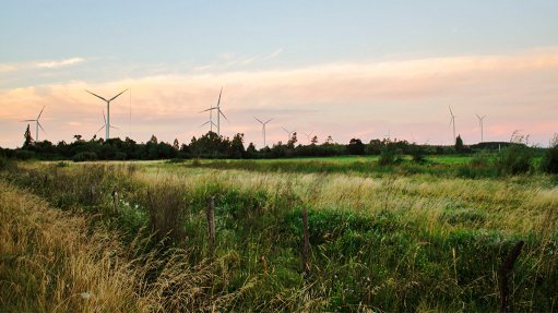
The WASA Large-Scale High-Resolution Wind Resource Map, available at http://www.wasaproject.info/, shows detailed information of the surface wind across South Africa such as mean surface wind speed that assists planners, wind farm developers and others to identify areas for wind exploration.
It also aids Government, through the Department of Environmental Affairs’ Strategic Environmental Assessment with wind development zones that support the country’s energy investment drive.
WASA 1 encompassed the Western Cape, and parts of the Northern Cape and Eastern Cape and was completed in 2014; it included nine wind measurement stations.
WASA 2 focused on KwaZulu-Natal, the Free State and remaining areas of the Eastern Cape and was completed in 2018; it included five measurement stations.
Subsequently, four additional wind measurement stations were erected in the Northern Cape in the beginning of September 2018 for WASA 3. An update to include this data is expected to be completed by 2020.
This brings the total number of WASA wind measurement stations in operation to 18 spread across five provinces, which cover an estimated 75% of South Africa’s land cover.
Effectively, WASA 1, 2 and 3 constitute the building blocks of the wind atlas that covers the whole of the country.