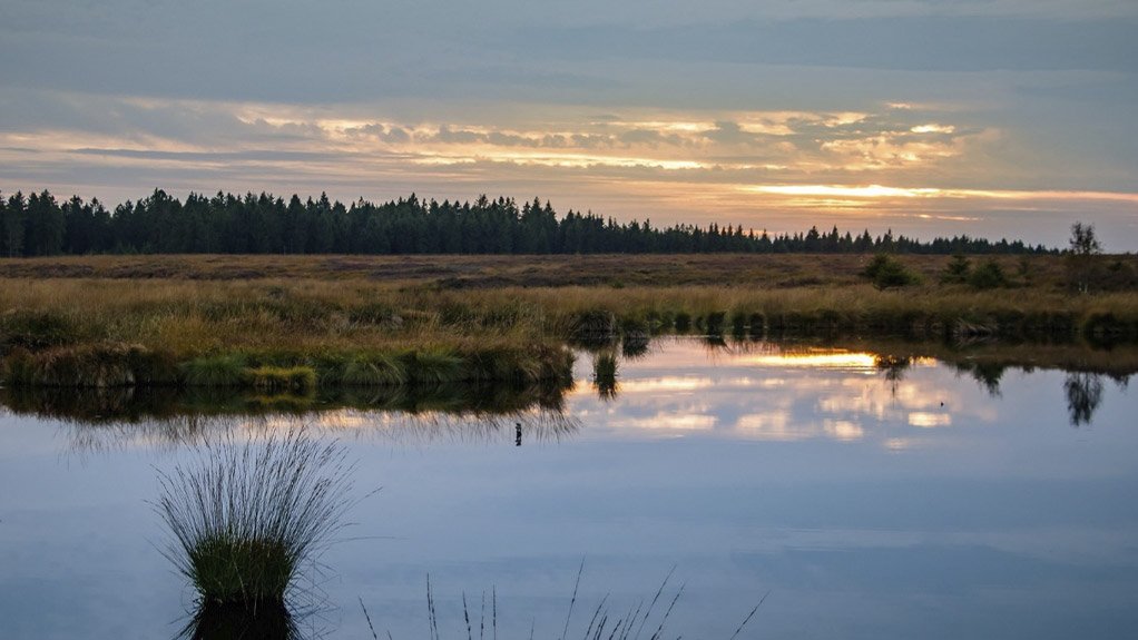
Updates to the WET-Health and WET-EcoServices suite of tools and how this will influence wetland assessments in South Africa


This article has been supplied as a media statement and is not written by Creamer Media. It may be available only for a limited time on this website.
(Showroom): The WET-Health and WET-EcoServices tools came into being out of a need to establish a baseline ecological condition and functional importance of wetlands prior to any potential impacts by proposed developments. According to Macfarlane et al (2007; 2020) ecological condition of Present Ecological State (PES) refers to:
‘The current state, compared to reference or best state, for the physical, chemical and biological characteristics of an ecosystem’.
In broad terms, functional importance refers to a wetland’s ability to provide ecosystem goods and services inclusive of the following (Macfarlane et al, 2008; 2020):
- Flood attenuation
- Streamflow regulation
- Sediment trapping
- Phosphate assimilation
- Nitrate assimilation
- Toxicant assimilation
- Erosion control
- Carbo storage
- Biodiversity maintenance
- Provision of water for human use
- Provision of harvestable resources
- Food for livestock
- Provision of cultivated foods
- Cultural and spiritual experience
- Tourism and recreation
- Education and research
The WET-Health and WET-EcoServices tools were developed in 2007 as part of a comprehensive wetland management programme which was initiated by the Water Research Commission (WRC) in 2003 which focused on wetland rehabilitation, wetland health and integrity and sustainable of wetlands (Macfarlane et al, 2008). Both tools form part of the WET-Management series which provides a host of tools for the origins, assessment, management and rehabilitation of wetlands.
Key updates to the WET-Health and WET-EcoServices Tools WET-Health Version 2 (Macfarlane, Ollis and Kotze, 2020) WET-EcoServices Version 2 (Kotze, Macfarlane and Edwards, 2020)
| Stronger emphasis on predetermined buffer, catchment and within wetland landcover classes. | Inclusion of riparian areas as an assessment unit. |
|
Provision of two desktop levels of assessment comprising of ‘Level 1A’ and ‘Level 1B’. The level 1A spreadsheet was designed for the assessment of several wetlands at a time. |
The supply and demand of the assessed services area assessed separately and the beneficiaries of the services are taken into consideration with particular emphasis on the level of dependency on the services being assessed. |
|
A more focussed integration of differences in wetland type and an expansion of the method to cater for wetland types not previously included. |
Deletion of 15 indicators and the addition of new indicators. |
|
An expansive revision of the geomorphology module to explicitly differentiate between impacts to geomorphic structure and geomorphic processes. |
Improvements to ease of use of the tool |
| The addition of the water quality module not previously part of the tool. | Refinements to the algorithms used to determine the scores for each ecosystem service. |
| Revision of the excel spreadsheets with the addition of drop-down boxes for the selection of options and several additional automated calculations to make the spreadsheets more user friendly. | Inclusion of more comprehensive guidance in terms of how the results of the ecosystem services assessment will support decision making. |
| Restructuring of the Level 2 spreadsheet to allow for more rapid data entry and to prevent duplication. | An integrated score with supply weighted higher than demand. |
| Integration of new research and information to refine scoring guidelines. | Using the size of the wetland/riparian area as a multiplier for determining functional hectare equivalents for offset calculations. |
| The addition of a module to carry out offset calculations for water resource management. | |
| The addition of recommendations for scoring overall Ecological Importance and Sensitivity (EIS) | |
|
Confidence scores no longer included for individual indicators. |
Implications for wetland assessments in South Africa
- All wetland practitioners will need to be trained in the use of the updated tools.
- Wetland practitioners will need to be well versed in the use of Geographic Information Systems (GIS) in order to accurately map the landcover classes.
- Wetland practitioners will need to have a strong understanding of the interpretation of aerial imagery in order to correctly identify landcover classes.
- Wetland monitoring programmes that utilised the previous methodologies will continue using those methodologies to ensure the results are comparable. Future wetland monitoring programmes will need to make use of the updated methodologies.
Comments
Research Reports

Projects


Latest Multimedia

Latest News

Showroom

ISO-certified Condra manufactures overhead cranes, portal cranes, cantilever cranes and crane components: hoists, drives, end-carriages, brakes and...
VISIT SHOWROOM


Press Office
Announcements
What's On
Subscribe to improve your user experience...
Option 1 (equivalent of R125 a month):
Receive a weekly copy of Creamer Media's Engineering News & Mining Weekly magazine
(print copy for those in South Africa and e-magazine for those outside of South Africa)
Receive daily email newsletters
Access to full search results
Access archive of magazine back copies
Access to Projects in Progress
Access to ONE Research Report of your choice in PDF format
Option 2 (equivalent of R375 a month):
All benefits from Option 1
PLUS
Access to Creamer Media's Research Channel Africa for ALL Research Reports, in PDF format, on various industrial and mining sectors
including Electricity; Water; Energy Transition; Hydrogen; Roads, Rail and Ports; Coal; Gold; Platinum; Battery Metals; etc.
Already a subscriber?
Forgotten your password?
Receive weekly copy of Creamer Media's Engineering News & Mining Weekly magazine (print copy for those in South Africa and e-magazine for those outside of South Africa)
➕
Recieve daily email newsletters
➕
Access to full search results
➕
Access archive of magazine back copies
➕
Access to Projects in Progress
➕
Access to ONE Research Report of your choice in PDF format
RESEARCH CHANNEL AFRICA
R4500 (equivalent of R375 a month)
SUBSCRIBEAll benefits from Option 1
➕
Access to Creamer Media's Research Channel Africa for ALL Research Reports on various industrial and mining sectors, in PDF format, including on:
Electricity
➕
Water
➕
Energy Transition
➕
Hydrogen
➕
Roads, Rail and Ports
➕
Coal
➕
Gold
➕
Platinum
➕
Battery Metals
➕
etc.
Receive all benefits from Option 1 or Option 2 delivered to numerous people at your company
➕
Multiple User names and Passwords for simultaneous log-ins
➕
Intranet integration access to all in your organisation