How one SA company mines SA’s satellite-imagery resource to make life easier while making a profit


There’s more to geography than capitals, clouds and tornados, climate, countries, people, maps and flags. Today, geography is a serious consumer-facing business, helping us to reach our destinations with the aid of global positioning systems (GPSes) on our cellphones, or even the simple road map, while enabling us, with the click of a mouse, to pinpoint our houses with the help of Google Earth.
Yet, there is little popular understanding of just how all this information is provided, with few of us truly taking the time to philosophise, as Socrates did in 450 BC, that “man must rise above the earth – to the top of the atmosphere and beyond – for only then will he fully understand the world in which he lives”.
But even the great Socrates could not have imagined a time when humanity would have the tools that could enable such high-resolution visibility from the lofty altitude of space – a reality that many South Africans probably grasped a little better since last month with the successful launch of South Africa’s home-grown Sumbandilasat satellite.
The fulfilment of the Socrates vision really started on October 4, 1957, when the Soviet Union launched the world’s first artificial satellite, Sputnik I.
According to National Aeronautics and Space Administration records, the satellite was about the size of a beach ball at 58 cm in diameter and weighed 83,6 kg. It took about 98 minutes to orbit the earth.
National Resource
Since that date, more satellites have been launched and, as technology advanced, so did the applications, from defence to weather to broadcasting.
South Africa’s Space and Sustainable Development Policy has officially recognised the importance of satellites, stating: “[They] support sustainable development by pro-viding up-to-date and comprehensive geo-spatial information to support planning and decision-making. Geospatial information acquired from space complements measurements obtained on the ground in a powerful way. Satellites further support sustainable development by facilitating communications and sharing of information.”
The policy further explains that most satellites are capable of being used for a variety of applications during operational life. “All satellite data are archived, providing a valuable data bank for future, unanticipated applications, long after the satellite has ceased to operate. This provides a valuable return on the cost of building and launching the satellite. In South Africa, the Council for Scientific and Industrial Research’s Satellite Applications Centre maintains an archive of images taken by a variety of satellites dating back to 1972. This archive is a national resource.”
Arguably, Sumbandilasat, launched in September from the Baikonur cosmodrome by Russian space agency Roscosmos on a Soyuz-2 rocket, underlined this belief in a highly visible and practical way.
Bringing Information to Life
But on a far lower key scale, one South African company has for some time now been actively exploiting this national resource for very down-to-earth, practical applications and for profit.
In fact, image extraction specialist and geographic information systems (GIS) service provider Geoterraimage (GTI), of Pretoria, has used the images and information garnered from space to do everything from designing systems, to providing information for telecommunications infrastructure roll-outs, to analysing urban development trends, natural changes and conservation, disaster threats, and food supply – and far more to boot.
Since its establishment in 1999, GTI’s mission has been to assist its clients “get things right the first time”, by using geography as a tool to show spatial concepts, relationships and patterns, and by integrating all the information it gathers from satellite images into one package.
“In simple terms, we make maps,” GTI business development director and Geo Information Society of South Africa Gauteng chapter chairperson Stuart Martin tells Engineering News in an interview.
“We extract information from satellite imagery or aerial photos and make the information come to life,” he enthuses, adding that it will identify the water bodies, and distinguish residential, commercial, and farming areas.
To do this, five components are integrated: people, hardware, software, data and applications. “By breaking that down, you get slices of information which, when placed together, provide a statistical image of the area’s history and how different factors influence each other,” Martin elaborates.
Such intelligence brings both problems and possible solutions to the fore.
For instance, the company, which employs 11 highly skilled GIS and remote sensing analysts, has been involved with parastatals that are developing new infrastructure in support of service delivery across South Africa.
“Land cover and land use maps are needed to understand the impact of the developments on an area in the short to medium term. For example, if there are wetlands surrounding an area being developed, the organisations need to know whether its activities will have a negative impact.”
A thematic map showing every built- environment structure in South Africa has also been prepared for Eskom, to enable it to understand formal and informal development trends and to overlay that with its electrification plans.
Cast in Concrete
Another concern, which GIS can address, is sealed surfaces. In Johannesburg, for example, the city has been sealed solid with concrete, which does not allow for water to drain into the ground. Therefore, water can cause flooding without the proper preventive stormwater drains and channels.
Centurion, in Pretoria, is another case where sealing of the surface and new developments are causing changes in water flow patterns. This has led to siltation in the Centurion Mall area, where a small wetland has built up because all the building activity upstream has diminished the grass and vegetation and resulted in the creation of a wetland. Some of the water catchment areas in Centurion have, thus far, been built up by over 40%, which means that the city’s municipality needs to manage 40% of the water flow that cannot drain away naturally.
“Centurion has a large dolomite area that can cause many problems. One can, however, live in perfect harmony with dolomite, but if the stormwater isn’t managed correctly, then the water will dissolve the dolomite and cause sinkholes. This is evident in the massive sinkhole that appeared near the Centurion golf estate about a year ago,” Martin adds.
GIS has also been deployed to assists with food security, by establishing how much maize and wheat have been planted, and determining whether there will be a food shortage or oversupply.
But there is a plethora of other applications and emerging applications. The solution is widely employed in town planning, as well as to assist in gaining a better understanding of ecosystem and animal migration. It identifies, for example, the east, west, north and south corridors that should be left open for the migration of species, which will be required owing to global climate change.
But it’s also a tool of democracy and crime prevention, with GIS maps also playing a material role in the Independent Election Commission’s planning for political elections and in helping the authorities to understand crime patterns and where different types of crimes occur most often.
The Future of Mapping
GIS mapping is important for government and companies in order to understand the dynamics of the country and the pressures on infrastructure and natural resources, and, ultimately, the impact on the country.
“We need to understand our country and where people live, and where there are pressures on growth.
“The amount of change in Johannesburg alone is massive – we are not living in a developed, stabilised country where development is relatively controlled and steady – there are massive shopping centres, hectares of houses, townhouses and other developments coming up all over the place,” Martin avers.
He also believes that, given the growing pressure for service delivery, GIS will become increasingly important to both understanding the gaps and quantifying what has been done.
It will also make visible the contest between people and the planet and provide planners with tools to make choices about when a certain natural feature needs to be safeguarded against both the planned and unplanned encroachment of people.
“I believe we are reaching the point where people in authority, in both government and business, are becoming aware of what geography can mean for them practically, as well as for the prospects of the nation,” Martin concludes.
Comments
Research Reports
Projects
Latest Multimedia
Latest News

Showroom
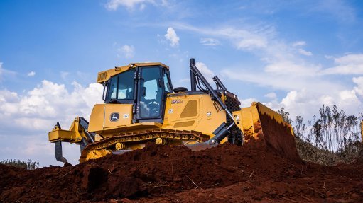
In 1958 John Deere Construction made its first introduction to the industry with their model 64 bulldozer.
VISIT SHOWROOM
Announcements
What's On
Subscribe to improve your user experience...
Option 1 (equivalent of R125 a month):
Receive a weekly copy of Creamer Media's Engineering News & Mining Weekly magazine
(print copy for those in South Africa and e-magazine for those outside of South Africa)
Receive daily email newsletters
Access to full search results
Access archive of magazine back copies
Access to Projects in Progress
Access to ONE Research Report of your choice in PDF format
Option 2 (equivalent of R375 a month):
All benefits from Option 1
PLUS
Access to Creamer Media's Research Channel Africa for ALL Research Reports, in PDF format, on various industrial and mining sectors
including Electricity; Water; Energy Transition; Hydrogen; Roads, Rail and Ports; Coal; Gold; Platinum; Battery Metals; etc.
Already a subscriber?
Forgotten your password?
Receive weekly copy of Creamer Media's Engineering News & Mining Weekly magazine (print copy for those in South Africa and e-magazine for those outside of South Africa)
➕
Recieve daily email newsletters
➕
Access to full search results
➕
Access archive of magazine back copies
➕
Access to Projects in Progress
➕
Access to ONE Research Report of your choice in PDF format
RESEARCH CHANNEL AFRICA
R4500 (equivalent of R375 a month)
SUBSCRIBEAll benefits from Option 1
➕
Access to Creamer Media's Research Channel Africa for ALL Research Reports on various industrial and mining sectors, in PDF format, including on:
Electricity
➕
Water
➕
Energy Transition
➕
Hydrogen
➕
Roads, Rail and Ports
➕
Coal
➕
Gold
➕
Platinum
➕
Battery Metals
➕
etc.
Receive all benefits from Option 1 or Option 2 delivered to numerous people at your company
➕
Multiple User names and Passwords for simultaneous log-ins
➕
Intranet integration access to all in your organisation